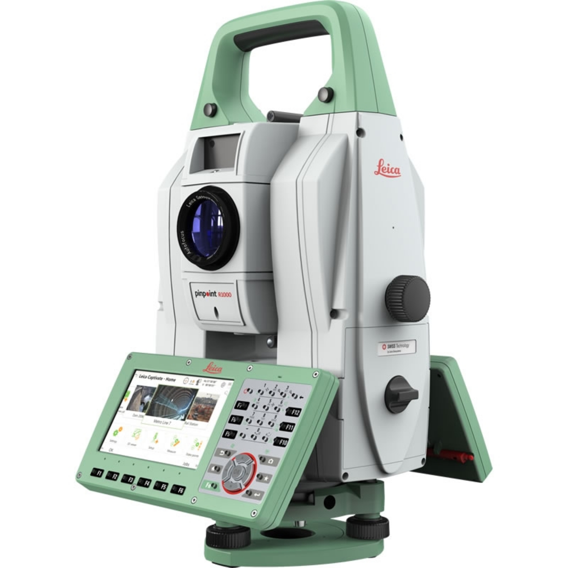
 Leica Nova TM60 Total Station
 Detailed Description
Experience unparalleled precision and reliability with the Leica Nova TM60 Total Station, engineered for both long-term and campaign monitoring. This sophisticated monitoring solution stands out with its unique combination of cutting-edge technology and robust performance tailored for professional users across a multitude of industries. Whether you are focused on continuous structural monitoring, environmental assessments, or managing energy sector applications, the TM60 is specifically designed to adapt seamlessly to diverse project demands while providing vast measurement ranges and exceptional accuracy. This device allows for real-time decision-making, ensuring that you stay ahead of potential risks and challenges on-site. Built for the modern-day surveying engineer, the TM60 boasts an impressive half-second automatic aiming accuracy, making every measurement count. With long-range automatic target recognition, it eliminates downtime, allowing users to focus on critical assessments and strategic evaluations without worrying about the intricacies of manual targeting. Furthermore, the device features a powerful 5-megapixel CMOS camera that enhances data documentation with high-resolution imagery. Place your confidence in the TM60's ability to handle various environments; its rugged, IP65 rated construction is designed to withstand harsh conditions, ensuring dependable performance wherever your work may take you. The integrated Leica Captivate field software facilitates an intuitive user experience, providing smart apps and touch technology that make campaign monitoring straightforward and effective. Set up your monitoring campaigns with ease, take advantage of automated measuring routines, and instantly visualize and manage your data—all in one comprehensive platform. For those overseeing critical infrastructure projects such as bridges, tunnels, or high-rise buildings, this total station offers critical insights into structural integrity, allowing proactive interventions to mitigate potential safety issues. A standout feature is the flexibility in connectivity options, which includes RS232, USB, Bluetooth®, and WLAN. This connectivity ensures effortless data transfer and system integration, streamlining your monitoring workflows. Additionally, with up to 9 hours of battery life on a single charge, the Leica Nova TM60 enables uninterrupted continuous monitoring, allowing you to concentrate on your projects without the hassle of frequent recharging. Weighing only 7.2 kg, its compact and lightweight design makes it incredibly portable, making it an ideal choice for fieldwork across various locations. Discover the next level of monitoring technology with this sophisticated total station and transform the way you approach your projects.
Features & Benefits
- Lowest Downtime: Enjoy peace of mind with the longest continuous operation in the field and the longest maintenance intervals (yearly).
- No Data Gaps: Experience uninterrupted data collection with the new Leica GeoMoS Edge technology.
- ATRplus Technology: Benefit from the world’s first self-learning monitoring total station, enabling advanced automation and exceptional measurement performance up to 3,000 m.
- Adaptability: No need to adjust for changing environmental conditions, ensuring reliable data capture in various situations.
- Leica GeoMoS System: Access an automatic deformation monitoring system designed to quickly address complex project demands with flexibility.
- AutoLearn Feature: Automate the search, aim, and measurement of monitoring prisms, enhancing operational efficiency.
- Expanded Field of View: Benefit from a larger target detection area thanks to ATRplus, improving monitoring capabilities.
- Remote Monitoring: Allow for autonomous and remote detection of monitoring targets, thus reducing the need for manual interventions.
- Robust Performance: Reliable and durable instrument, designed for consistent use in varying field conditions.
- User-Friendly Interface: Simplifies operations, making it accessible for both experienced and new users in the field.
Technical Specification
Inst Reflectorless Range
1000m
Angular Accuracy (")
0,5
Total Station Type
Robotic
Interfaces
RS232 USB Bluetooth WLAN
Document Download
Documentation File Format Size
What's In The Box
Need some help?

